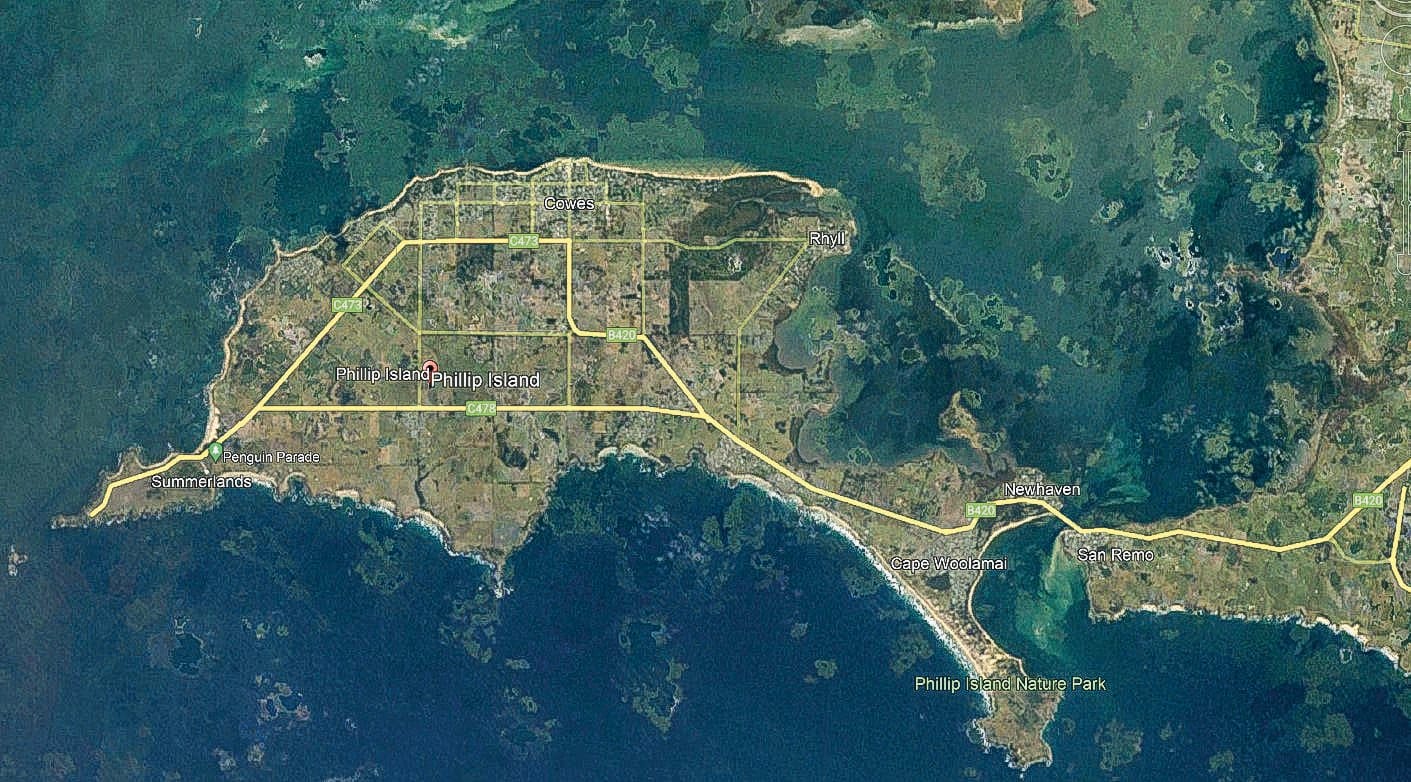
How green is our island?
Phillip Island was stripped of 93 per cent of its trees and plants at the peak of destruction, according to a Bass Coast Shire report.

Phillip Island was stripped of 93 per cent of its trees and plants at the peak of destruction, according to a Bass Coast Shire report.
However, over the past decade tree planting by farmers and community groups has seen that worst-case figure improve, with the island now covered by 20 per cent of vegetation.
The shire’s Bass Coast Biodiversity Biolinks Plan shows across the region there is less than 14 per cent of native vegetation cover.
“The native vegetation on Phillip Island was estimated at seven per cent cover in 1997 from aerial maps,” the report states.
“Since then, millions of native plants have been planted by community groups, Landcare, landowners, council and government authorities and Phillip Island Nature Parks. This has increased the cover across Phillip Island which now has approximately 20 per cent native vegetation cover.”
The plan identifies more than 200 areas around the shire for re-planting, including Phillip Island’s wildlife corridor, which runs east to west and was planted about 15 years ago.
“This corridor links the two largest patches of remnant vegetation from the Koala Conservation Reserve to the Penguin Parade.,” the report states.
“This corridor could be assessed and widened in consultation with the landholders.”
Under the plan, landowners and community groups are working to increase tree cover by 1.5 per cent annually, equivalent to 180 hectares of revegetation, or about 360,000 plants, in order to create wildlife corridors.
Urban trees
Phillip Island arborists have estimated about 30 per cent of the island’s urban tree canopy had been removed following the 10/30 rule, which was introduced after the Bushfire Royal Commission a decade ago, allowing trees to be removed – without a planning permit – within 10 metres of a dwelling (built before 2009).
Even though the 10/30 rule was designed to protect homes from bushfires, landowners who faced no threat from bushfires had been destroying trees across the island.
But in 2020 the rule was amended, only applying to properties located within a declared Bushfire Prone Area, with permits largely required for the removal of any vegetation in areas where protection controls are in place.
The arborists said while a generation of mature trees was being lost, there were no younger trees establishing themselves, adding it takes many decades to replace canopy trees.
They said when a clump of trees was removed this created a “wind load effect” on other trees, where others fell over or had limb problems because they were no longer buffered by the previous cluster.
“If we’ve lost that many in 10 years, what’s it going to be like in the next decade?” one arborist said, adding while many people wanting trees removed sought a view, “an amazing number of people are leaf-haters who want a pristine lawn”.
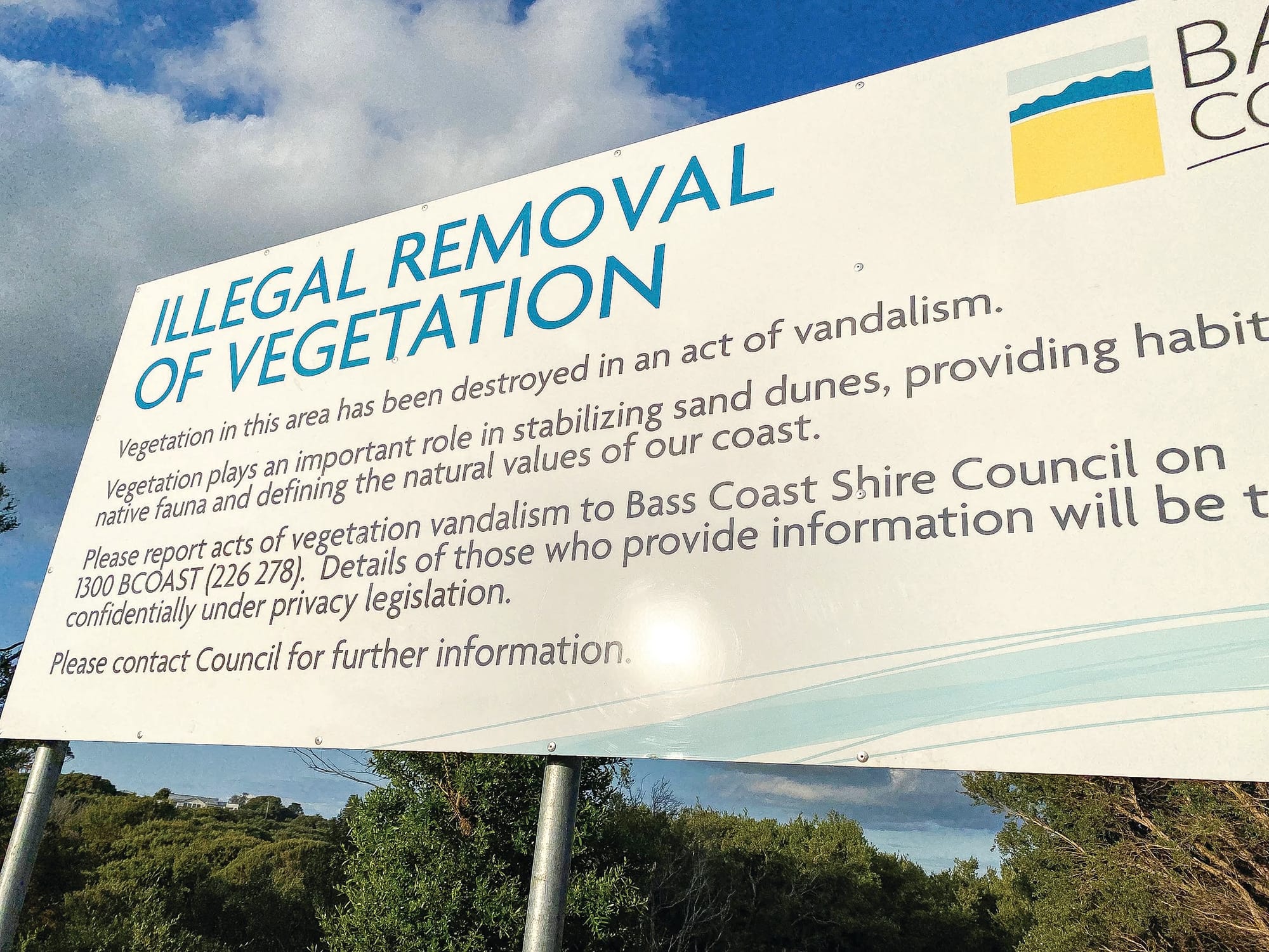
Crackdown
In a bid to reverse the decline of trees, at the end of last year the Bass Coast Shire announced a big crackdown on illegal foreshore vegetation destruction.
The new Foreshore and Bushland Reserves Vegetation Protection Policy introduces a range of measures to protect beach trees, including:
- carry out proactive surveillance or monitoring of “hot spots” to gather information which may support enforcement activities;
- advocate for increases in the penalties that can be applied to illegal damage to vegetation;
- exclude or limit public access, including fencing, or fill the view-lines with signs that can stay in place until the new vegetation recovers to the height of the previous vegetation;
- lab-test leaf samples for evidence of herbicide use; and
- respond to incidents of vegetation damage by interviewing persons who have notified council of damage, contacting owners of property potentially gaining a benefit from the damage, and contacting a broad group of nearby property owners.
In a strongly worded statement, the new policy states the shire will “not tolerate acts of deliberate and unauthorised damage to vegetation on public land”.
The policy states illegal removal includes felling or trimming vegetation, as well as poisoning, on the 40km of Crown land managed by the shire, from Ventnor through to Rhyll, as well as Newhaven and Cape Woolamai, in addition to 160 hectares of inland reserves such as Ventnor Common and Saltwater Creek Reserve.


